


AGV Navigation Types: Magnetic Tape, QR Code, Laser & Natural Navigation
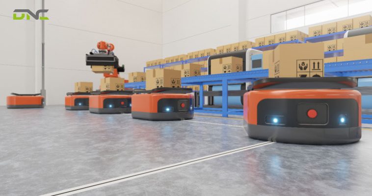
AGV navigation types fall into four families, and the clearest way to tell them apart is where each one keeps its position reference. Magnetic tape navigation follows a strip on the floor. QR code navigation reads a grid of codes printed on the floor. Laser navigation measures angles to reflectors mounted on walls and pillars. Natural navigation matches a laser scan of the building’s own walls, columns and fixed machinery against a stored map, the method also sold as SLAM or free navigation.
Where the reference lives decides what can break it: forklift wheels wear a floor strip, a blocked sight line hides a reflector, a moved machine changes the map. This guide covers the four AGV navigation types in turn, then compares them in one table and gives a selection sequence for Malaysian factories and warehouses. DNC Automation specifies AGVs against that sequence.
What an AGV Navigation System Does
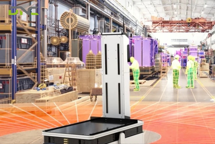
An AGV navigation system is the position loop that tells an automated guided vehicle where it is, where it has to go and how to steer between the two. The vehicle reads an external reference, calculates its position, corrects its steering, and reports that position to the fleet manager, which then sends the next transport order. Encoders on the drive wheels fill the gaps between reference readings. They count wheel rotation to estimate how far the AGV has travelled from its last known point, a method called odometry or dead reckoning.
The fleet manager sits above the vehicle. It distributes transport orders, calculates the shortest permitted path, and talks to each AGV over Wi-Fi and to doors, lifts and conveyors through I/O signals. The navigation type does not change this layer. It changes only the reference the vehicle reads, and that reference is also where the system is most exposed on a working factory floor.
Floor references can also carry commands. On magnetic tape systems, short strips laid beside the main track in set combinations of polarity, sequence and spacing tell the AGV to change lane, speed up, slow down or stop. Everything the vehicle does at those points depends on the strip being intact and readable. Where that reference sits is what separates one AGV navigation type from the next.
What an AGV Navigation System Does
Where Each AGV Navigation Type Keeps Its Reference
Each AGV navigation type keeps its position reference in one of three places: on the floor, on the walls, or in a map inside the vehicle. That location predicts three practical outcomes better than any brochure claim does: what installation involves, what a layout change costs, and what degrades accuracy over time. The three locations sort the navigation types as follows:
| Reference location | AGV navigation types | Installation work | What disturbs it |
| Floor surface or slab | Magnetic tape, magnetic spot, inductive wire, QR code | Tape, magnets, cut slots or printed codes on the floor | Wheel traffic, floor wear, uneven or wet floors |
| Walls, pillars, fixed machines | Laser navigation with reflectors | Reflectors mounted at scanner height, positions surveyed | Blocked sight lines, moved reflectors, smoke, reflections |
| The vehicle’s own map | Natural navigation (scan matching / SLAM, feature matching), vision | Mapping drive; occasional reflective stickers | Moved walls or machinery, large layout changes, lighting (vision) |
Floor-bound references are unaffected when pallets, racking or other vehicles appear and disappear around the path. The cost of that stability is physical work on the slab each time a route changes, and wear on tape, paint and codes that eventually leaves gaps in a route. Map-bound references reverse that trade-off: route changes happen in software, and the risk moves to how much of the building the vehicle can still recognise. The floor-bound group starts with magnetic tape.
Magnetic Tape Navigation
Magnetic tape navigation guides an AGV along a strip of magnetic tape stuck to the floor, which sensors under the vehicle detect and follow. The standard tape is about 1 mm (0.04 in) thick and 5 cm (2 in) wide, with a high-bond adhesive backing, so it sits almost flush with the floor surface. The AGV does not calculate a position of its own. It follows the tape without deviation, which makes its route completely predictable.
Tape navigation earns its place on fixed, repetitive routes. Investment is lower than most other AGV navigation systems and it needs little IT infrastructure. Rerouting means lifting and relaying tape rather than cutting the floor, and repeatability is high enough for narrow aisles. A line-feeding loop between two fixed workstations is the typical case.
The limits come from the same strip. Forklift wheels and other machinery damage tape, so integrators rule it out for high-traffic aisles and outdoor runs. One AGV integrator’s guidance states that tape guidance will not work with a forklift-type vehicle. The finite length of tape also caps how many vehicles a route can hold. A tape-guided AGV stops for an obstacle but cannot steer around it, so one misplaced pallet halts the loop until someone moves it. Two other floor-bound methods avoid a surface strip altogether.
Magnetic Spot and Wire: Floor Guides Without Tape
Magnetic spot and inductive wire navigation keep the reference in the floor but move it below the surface. Magnetic spot systems embed small cylindrical magnets of about 20 × 10 mm (0.8 × 0.4 in) at intervals of 250-500 mm (10-20 in). The vehicle follows a CAD route map in its controller and uses each magnet as a checkpoint, with encoders correcting steering-angle error between spots. Because the path is virtual between magnets, routes can be re-programmed without moving every puck. Extensive layouts still make puck placement complex.
Inductive wire navigation cuts a slot into the floor and lays a wire that emits a field the vehicle senses from underneath. Buried wire survives heavy traffic, and its radio signal ignores smoke, steam and dust. Every route change means cutting and reinstalling wire, and slopes or uneven floors complicate the installation. Inertial (gyroscopic) guidance pairs floor transponders or magnets with a gyroscope that corrects heading between them. One published figure puts its margin of error at ±1 inch, and it drifts without periodic correction from a fixed reference. QR codes keep the reference on the floor but let a camera read it instead of a magnetic sensor.
QR Code Navigation
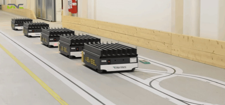
QR code navigation places a grid of printed codes on the floor, and a downward-facing camera on the AGV reads each code to fix both position and heading. Each code works as a numbered checkpoint. The vehicle drives from one code to the next and, between codes, the route exists only in the controller. Changing a route is a programming task, and the codes themselves stay where they are.
QR code guidance is the most precise way to navigate an AGV without a continuous line. One material handling supplier puts spot-grid positioning, magnetic or QR, at up to 0.1 inch (about 2.5 mm), second only to line-following tape. Codes cost little to lay, and a camera reads a printed line or code from further away than a sensor reads magnetic tape. Some line-guided systems read 2D codes printed along the path to take commands and confirm position in the driving direction.
The trade-offs are on the floor again. QR codes need a flat floor and periodic replacement as wheels wear them, while magnetic markers need almost no maintenance. Laying the grid demands careful placement, and adding destinations takes more IT support than extending a tape line. That floor work is the reason DNC Automation’s own autonomous mobile robot range is marketed on the opposite promise, “no need to lay magnetic tapes or QR codes on the ground”. Buyers choose between a code grid’s precision and a code-free floor. Laser navigation is the first method that takes the reference off the floor entirely.
QR Code Navigation
Laser Navigation With Reflectors
Laser navigation moves the AGV’s position reference off the floor and onto reflectors mounted around the operating area. A 2D navigation scanner on the vehicle emits a modulated laser beam through 360°, measures the angle and distance to each reflector it sees, and triangulates its position against a stored reflector map. Depending on the scanner maker, the vehicle recalculates its position 30-40 times per second. The reflector map is held on a master controller or central server, and routes are virtual lines drawn in software.
Reflector geometry sets the rules for installation. The vehicle needs at least three reflectors in view at any moment. Each reflector’s centre sits at the same height as the scanner and within 30 m (98 ft) of the vehicle. Reflectors go on walls, pillars and fixed machines, and a surveyor measures each position before the system enters service. Designing the reflector layout, installing it and validating it is the slow, expensive part of a laser-guided project.
Once the reflectors are in place, laser guidance is one of the most flexible and accurate AGV navigation systems for forklift-type vehicles. A new route or an extra vehicle is a software change, as long as the reflectors stay put. The scanner usually sits on top of the vehicle to see as many wall reflectors as possible, and low underride AGVs have nowhere to mount it. Smoke, airborne debris and stray reflections can degrade accuracy, and so can direct sunlight dazzling the laser, for example through an open dock door. Natural navigation removes the reflectors as well.
Natural Navigation: SLAM and Feature Matching
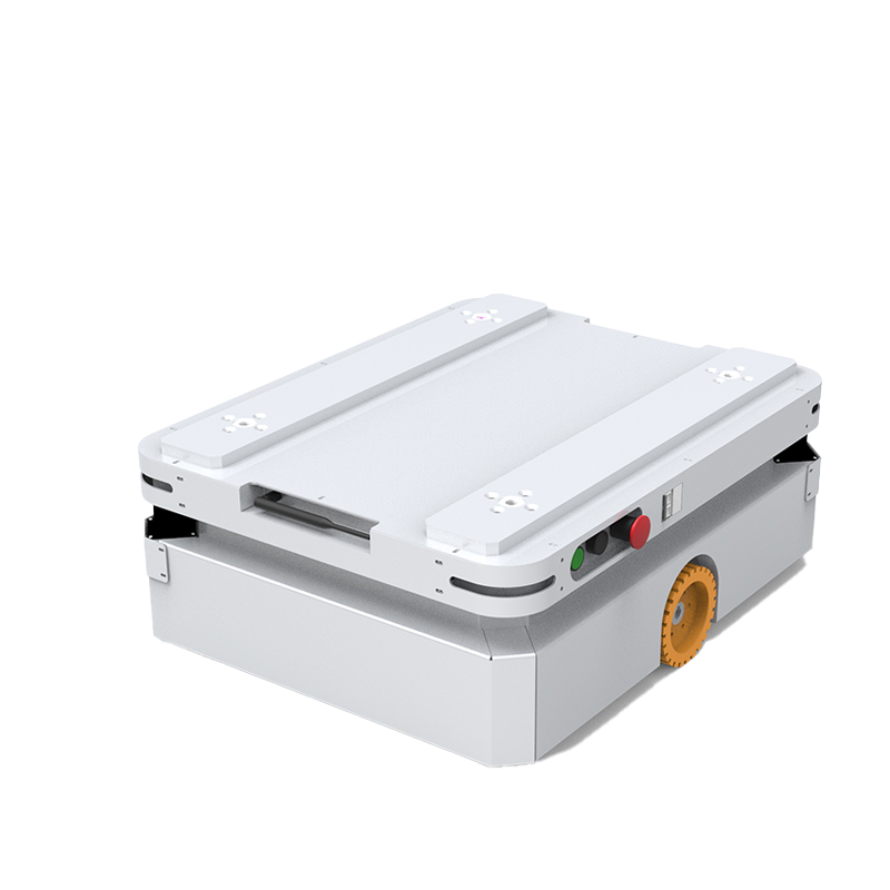
Natural navigation locates the AGV by scanning the building itself, using walls, columns and fixed machinery as the position reference instead of tape, codes or reflectors. It is also called free navigation or contour navigation. The laser scanner measures the surroundings, the controller matches the scan against a stored map, and odometry carries the position between scans. Nothing is installed on the floor, and reflectors are optional.
Two different methods share the natural navigation label. Scan matching, usually sold as SLAM (simultaneous localization and mapping) navigation, compares thousands of measured points with a grid-based reference map. Feature matching compares only permanent, static features, such as walls and pillars, with a feature-based map and ignores people and pallets.
One navigation-software maker states that scan matching is more sensitive to materials appearing and moving, and often needs an extra scanner mounted high on the vehicle. The same maker says its feature-matching vehicles use their ankle-height safety scanners, keep navigating with under 5% of features visible, and repeat to 1 cm and 1°. Those figures come from a vendor promoting its own method.
Published natural navigation accuracy is wider than floor-guided accuracy. The SLAM AMRs in DNC Automation’s range list repeat positioning of ±10-30 mm, and ±20-30 mm for the lightest model. That band is enough for transport between zones but not for every transfer point. Natural navigation also carries a heavier programming load, and a chaotic, constantly changing floor can reduce the fixed features a scanner can match. Vision guidance, the camera-based variant, installs without infrastructure but is sensitive to lighting changes. Every natural navigation route starts from a map of the site.
Natural Navigation: SLAM and Feature Matching
How a Natural Navigation Map Is Built
A natural navigation map is built from the plant itself in five steps:
- The plant supplies a floor plan, and routes and actions are drawn on it: pick-up points, fork lifts, and PLC handshakes.
- The AGV is driven around the operating area while its scanners record the surroundings as a 2D map.
- Engineers delete dynamic objects, such as pallets, trolleys and parked vehicles, so only fixed references remain.
- The map and routes are fine-tuned and checked on the floor.
- The AGV starts running its routes. The map needs no update until a fixed structure moves.
With all four references described, their trade-offs fit in one table.
AGV Navigation Types Compared
The four AGV navigation types trade installation work against how easily routes change and against what disturbs the vehicle. The table below sets them side by side, using the figures and limits published by AGV makers and integrators.
| AGV navigation type | Reference | Published accuracy reference | Floor or site work | Route change | Main vulnerability |
| Magnetic tape | Tape strip, 1 mm × 5 cm | Most accurate overall (line following) | Tape on floor | Relay tape | Forklift traffic, obstacles on the line |
| Magnetic spot / inductive wire | Magnets every 250-500 mm / buried wire | High; inertial ±1 inch | Drilled magnets / cut slot | Re-program (spot) / re-cut (wire) | Floor work, slopes |
| QR code grid | Printed codes on floor | Up to 0.1 inch (about 2.5 mm) | Code grid on flat floor | Re-program | Code wear, uneven floor |
| Laser with reflectors | Reflectors at scanner height, ≤30 m | High; 30-40 position fixes per second | Reflector install + survey | Software, unless reflectors move | Blocked sight lines, sunlight, smoke |
| Natural (SLAM / feature matching) | Walls, pillars, machines in a map | 1 cm / 1° (vendor); ±10-30 mm (DNC AMR datasheet) | Mapping drive only | Software | Moved fixed structures, cluttered floor |
Summary So Far
Floor-bound AGV navigation types, magnetic tape, magnetic spot, wire and QR code, give the tightest positioning and ignore changes around the path. They pay for that with floor work at every route change and wear from wheel traffic. Laser navigation moves the reference to surveyed wall reflectors and keeps high accuracy with software routing, as long as the reflectors stay in sight. Natural navigation needs no installed reference, but its published accuracy band is wider. So the choice turns on two questions: how precisely the AGV has to stop at each station, and how often the floor layout changes. Combining two navigation types in one vehicle answers both questions at once.
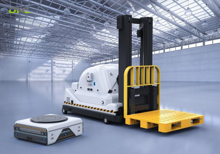
AGV Navigation Types Compared
Combining Navigation Types in One AGV
Combining navigation types in one AGV resolves the accuracy-versus-flexibility trade-off at the points where it matters. Many AGV systems blend two methods so that each covers the other’s weakness. The most common pairing uses natural navigation for open travel and a more precise reference, such as a magnetic tape section, magnets or a QR code patch, for narrow areas. Laser guidance also combines with GPS for moves between buildings and with magnetic tape for tight aisles.
The station tolerance decides where the precise reference goes. DNC Automation’s AGV and AMR range shows the split in its own datasheets. The AGVs pair a self-developed navigation and positioning system with DNC’s own motion controller for ±10 mm or ±5 mm (±0.39 in or ±0.20 in) positioning, and the SLAM AMRs repeat to ±10-30 mm (±0.39-1.18 in).
A pallet handed to a conveyor end has to stop where the end stop and side guides expect it. A trolley delivered to a line-side zone does not. A route can run on natural navigation for most of its length and add a precise reference only at the two or three stations where the tolerance is tight. Those stations are also where the selection sequence starts.
Choosing an AGV Navigation Type for Your Facility
An AGV navigation type is chosen station first and route second, because the tightest transfer point sets the minimum accuracy the whole system has to reach. When DNC Automation’s engineers assess a site, they measure the transfer points before looking at the aisles. Six questions, in this order, narrow the choice:
- What tolerance does each pick-up and drop-off point need?Write the tolerance down per station, then compare it with each method’s published class, for example ±5-10 mm for DNC’s AGVs and ±10-30 mm for its SLAM AMRs.
- What rolls over the route?Mixed forklift traffic rules out surface tape and wears QR codes. Buried wire or floor-free references survive it.
- How flat and clean is the floor?QR codes need a flat floor. DNC’s SLAM chassis is specified for floor flatness within ±10 mm.
- How often will the layout change?Monthly re-routing favours software-routed laser or natural navigation. A fixed loop between two machines is well served by tape.
- What does the scanner see?Open dock doors with direct sunlight, smoke, steam or reflective surfaces affect laser references. Lighting changes and lights-out shifts affect camera-based vision.
- Which vehicle carries the load?Top-mounted reflector scanners need a tall vehicle, and a low underride AGV cannot carry one. Tape guidance does not suit forklift-type vehicles.
For Malaysian plants automating transport because forklift drivers are scarce, these answers usually point to a hybrid. Natural navigation covers travel between areas, and a precise floor or reflector reference covers the few docking stations. The same vehicle family covers both roles. DNC Automation’s unmanned forklift series, for example, uses the same self-developed navigation system for ±10 mm pallet positioning. DNC’s guide to automatic guided vehicles covers vehicle types, controllers and lifecycle cost beyond navigation. Choosing a navigation type vehicle by vehicle has one more cost, which appears when the types on one site differ.
Running Mixed Navigation Fleets
Running AGVs with different navigation types on one site works on paper but costs more in practice. Each navigation platform usually arrives as a separate project with its own configuration software and fleet manager, and possibly its own integrator on site. Vehicles on different platforms rarely share traffic management natively, so crossings need extra interlocks or separate lanes, and separate lanes take extra floor space.
The practical rule is to pick one navigation platform that covers every vehicle type the site will need, including forklift, pallet and trolley vehicles. The fleet manager then connects once to the plant’s WMS or MES.
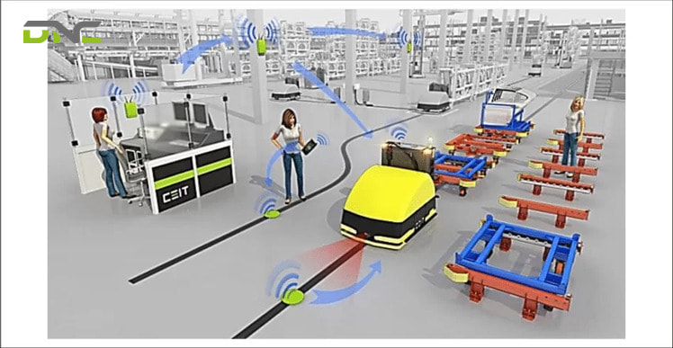
Running Mixed Navigation Fleets
Frequently Asked Questions About AGV Navigation Types
These questions about AGV navigation types cover accuracy, terminology, hybrid set-ups and the AGV-versus-AMR distinction, the points that come up once a Malaysian plant has shortlisted two or three navigation methods for its vehicles.
What are the main AGV navigation types?
The main AGV navigation types are magnetic tape, magnetic spot, inductive wire, QR code, laser navigation with reflectors, and natural navigation (SLAM or feature matching), with vision and inertial guidance as less common variants. They differ by where the position reference sits: on the floor, on the walls, or in the vehicle’s map.
Which AGV navigation type is the most accurate?
Line-following magnetic tape and floor-grid navigation are the most accurate in published comparisons, with spot and QR grids quoted up to 0.1 inch (about 2.5 mm). Integrators also rank laser reflector navigation among the most accurate methods. Natural navigation ranges from about 1 cm in vendor figures to ±10-30 mm on AMR datasheets.
Is natural navigation the same as SLAM?
Natural navigation is not the same as SLAM: SLAM, or scan matching, is one of two natural navigation methods. Scan matching compares the whole laser scan with a grid map. Feature matching compares only permanent features such as walls and pillars, which makes it less sensitive to pallets and materials moving around the vehicle.
How do hybrid AGVs combine QR code and laser navigation?
Hybrid AGVs combine QR code and laser navigation by travelling on laser or natural navigation and switching to QR codes, magnets or tape where they need tighter positioning, such as at a conveyor transfer or in a narrow aisle.
Does an AMR use the same navigation as an AGV?
An AMR does not use the same navigation as a classic AGV: it typically uses natural navigation with lidar and cameras, and it plans its own path around obstacles. A classic AGV follows a defined path on tape, wire, codes or reflector-based virtual routes. The line has blurred as AGVs adopt natural navigation. DNC Automation’s autonomous mobile robots run pure laser SLAM with no floor tape or codes.
- 1 views
- 0 Comment
Recent Comments